Kanchenjunga Trekking Guide: Routes, Permits & History

Overview
Duration: 27 Days
Secondary Activity: Nature and Culture
Max altitude: 5,388 m/17,673 ft
Transportation: Private Vehicle and Domestic Flight
Trip ends in: Kathmandu
Accomodation: Simple Local Cottage and Tent Camp
Primary activity: Trekking and Hiking
Group Size: Min. 2 Pax
Country: Nepal
Trip starts from: Kathmandu
Difficulty: Strenuous
Meals: Nepali Local and Continental
Best Season: Autumn and Spring
Introduction
Kanchenjunga, towering at 8,586 meters (28,169 feet), ranks as the third tallest Mountain in the world. Located in the eastern Himalayas, it spans the boundary between Nepal and the Indian state of Sikkim. This awe-inspiring summit is a natural wonder and holds prominent cultural and spiritual meaning for the local populations. “Kanchenjunga” means “Five Treasures of Snow,” representing its five distinguished peaks, each honored according to various regional customs. Beyond geographic borders, the sacred Kanchenjunga holds great cultural and spiritual significance for Nepalese people. The Mountain significantly impacts their daily lives, beliefs, and customs, so they revere and inspire it. It demonstrates the complex interdependence of nature and culture by influencing local climate conditions and supporting a variety of ecosystems. The surrounding region of Kanchenjunga includes Sikkims Khangchendzonga, the National Park, which is designated as a UNESCO World Heritage Site, emphasizing how vital the area is to the environment and how conservation measures are required to preserve its rich biodiversity and cultural legacy.
History
Over the past 65 million years, powerful global plate-tectonic forces have moved Earth’s crust to form the band of Eurasian mountain ranges including the Himalayas—that stretch from the Alps to the mountains of Southeast Asia.
During the Jurassic Period (about 201 to 145 million years ago), a deep crustal downwarp the Tethys Ocean bordered the entire southern fringe of Eurasia, then excluding the Arabian Peninsula and the Indian subcontinent. About 180 million years ago, the old supercontinent of Gondwana (or Gondwanaland) began to break up. One of Gondwana’s fragments, the lithospheric plate that included the Indian subcontinent, pursued a northward collision course toward the Eurasian Plate during the ensuing 130 to 140 million years. The Indian-Australian Plate gradually confined the Tethys trench within a giant pincer between itself and the Eurasian Plate. As the Tethys trench narrowed, increasing compressive forces bent the layers of rock beneath it and created interlacing faults in its marine sediments. Masses of granites and basalts intruded from the depth of the mantle into that weakened sedimentary crust. Between about 40 and 50 million years ago, the Indian subcontinent finally collided with Eurasia. The plate containing India was sheared downward, or subducted, beneath the Tethys trench at an ever-increasing pitch.
Kailas RangeNorthern side of Kangrinboqê Peak (Mount Kailas), in the Kailas Range, Trans-Himalayas, Tibet Autonomous Region, China.
During the next 30 million years, shallow parts of the Tethys Ocean gradually drained as its sea bottom was pushed up by the plunging Indian-Australian Plate; that action formed the Plateau of Tibet. On the plateau’s southern edge, marginal mountains—the Trans-Himalayan ranges of today became the region’s first major watershed and rose high enough to become a climatic barrier. As heavier rains fell on the steepening southern slopes, the major southern rivers eroded northward toward the headwaters with increasing force along old transverse faults and captured the streams flowing onto the plateau, thus laying the foundation for the drainage patterns for a large portion of Asia. To the south the northern reaches of the Arabian Sea and the Bay of Bengal rapidly filled with debris carried down by the ancestral Indus, Ganges (Ganga), and Brahmaputra rivers. The extensive erosion and deposition continue even now as those rivers carry immense quantities of material every day.
Finally, some 20 million years ago, during the early Miocene Epoch, the tempo of the crunching union between the two plates increased sharply, and Himalayan mountain building began in earnest. As the Indian subcontinental plate continued to plunge beneath the former Tethys trench, the topmost layers of old Gondwana metamorphic rocks peeled back over themselves for a long horizontal distance to the south, forming nappes. Wave after wave of nappes thrust southward over the Indian landmass for as far as 60 miles (about 100 km). Each new nappe consisted of Gondwana rocks older than the last. In time those nappes became folded, contracting the former trench by some 250 to 500 horizontal miles (400 to 800 km). All the while, downcutting rivers matched the rate of uplift, carrying vast amounts of eroded material from the rising Himalayas to the plains where it was dumped by the Indus, Ganges, and Brahmaputra rivers. The weight of that sediment created depressions, which in turn could hold more sediment. In some places the alluvium beneath the Indo-Gangetic Plain now exceeds 25,000 feet (7,600 meters) in depth. Probably only within the past 600,000 years, during the Pleistocene Epoch (roughly 2,600,000 to 11,700 years ago), did the Himalayas become the highest mountains on Earth. If strong horizontal thrusting characterized the Miocene and the succeeding Pliocene Epoch (about 23 to 2.6 million years ago), intense uplift epitomized the Pleistocene. Along the core zone of the northernmost nappes—and just beyond—crystalline rocks containing new gneiss and granite intrusions emerged to produce the staggering crests seen today. On a few peaks, such as Mount Everest, the crystalline rocks carried old fossil-bearing Tethys sediments from the north piggyback to the summits.
Once the Great Himalayas had risen high enough, they became a climatic barrier: the marginal mountains to the north were deprived of rain and became as parched as the Plateau of Tibet. In contrast, on the wet southern flanks the rivers surged with such erosive energy that they forced the crest line to migrate slowly northward. Simultaneously, the great transverse rivers breaching the Himalayas continued their downcutting in pace with the uplift. Changes in the landscape, however, compelled all but those major rivers to reroute their lower courses because, as the northern crests rose, so also did the southern edge of the extensive nappes. The formations of the Siwalik Series were overthrown and folded, and in between the Lesser Himalayas downwarped to shape the midlands. Now barred from flowing due south, most minor rivers ran east or west through structural weaknesses in the midlands until they could break through the new southern barrier or join a major torrent.
In some valleys, such as the Vale of Kashmir and the Kathmandu Valley of Nepal, lakes formed temporarily and then filled with Pleistocene deposits. After drying up some 200,000 years ago, the Kathmandu Valley rose at least 650 feet (200 meters), an indication of localized uplift within the Lesser Himalayas.
Height of Kanchenjunga
At 8586 meters (28169 feet), Mount Kanchenjunga is 262 meters (860 feet) lower than Mount Everest, which also rises to 8848 meters (29029 feet). These two mighty outstanding peaks are essential components of the Himalayan mountain range of Nepal. The relative heights of these two majestic mountains highlight their significance in high-altitude climbing. As the world’s highest peak, Everest attracts climbers worldwide, while Kanchenjunga is praised for its exceptional beauty and cultural significance.
Major Peaks of the Mt. Kanchenjunga Massif:
|
Peak Name |
Elevation (meters) |
Elevation (feet) |
Location |
|
Kanchenjunga Main |
8,586 |
28,169 |
Border of Taplejung District, Nepal, and Sikkim State, India |
|
Yalung Kang (Kanchenjunga West) |
8,505 |
27,904 |
Taplejung District, Nepal |
|
Kanchenjunga Central |
8,482 |
27,828 |
Border of Taplejung District, Nepal, and Sikkim State, India |
|
Kanchenjunga South |
8,494 |
27,867 |
Border of Taplejung District, Nepal, and Sikkim State, India |
|
Kangbachen
|
7,903 |
25,928 |
Taplejung District, Nepal |
Kanchenjunga Climbing Route
Ascending this daunting mountain comes with considerable challenges, and over the years, various routes have been established, mainly from the Nepalese side. Each route offers unique difficulties and experiences, drawing climbers eager to test their skills and resilience. As climbers navigate these routes, they are rewarded with breathtaking views and a profound sense of achievement.
Southeast Ridge (Yalung Face): This route is the most frequently used and is regarded as the standard path for ascending Kanchenjunga. It was the same route during the first successful ascent 1955 by climbers Joe Brown and George Band.
The journey begins at the Yalung Glacier, approaching the Mountain from the southwest. Climbers traverse the Yalung Face, an expansive area covered in snow and ice, to reach the Great Shelf, a notable sloping plateau at about 6,500 meters. From there, the ascent continues, requiring climbers to navigate various icefalls and seracs before finally reaching the summit ridge.
Southwest Ridge: This route is less commonly used due to its inherent hazards and technical difficulties. Climbers approach the Mountain’s southwest slopes from the Yalung Glacier, encountering steep ice and rough terrain that demand precise navigation and advanced climbing skills to navigate avalanches and prevent serious falls safely.
Northeast Spur: This route was first successfully ascended by an Indian Army team in 1977. From the northeastern side, climbers face a significant spur combining rock, ice, and snow climbing. Known for its continuous technical challenges, this route also exposes climbers to the harsh conditions often found at high altitudes. Navigating this path requires physical strength and mental resilience, as climbers must adapt to rapidly changing weather and rugged terrain. Each ascent brings a sense of adventure and achievement as trekkers conquer the demanding elements and push their limits. The experience of climbing this route offers a unique perspective on the Mountain’s beauty and formidable challenges, making it a rewarding journey for those who dare to take it on.
North Face: This route is among the least frequently attempted, primarily because of its remote access and challenging climbing conditions. Climbers must navigate the intricate terrain of the Kangchenjunga Glacier, tackling steep ice faces and crossing areas filled with crevasses.
Climbing Challenges
Kanchenjunga is well-known for its technical challenges, erratic weather, and significant risk of avalanches. Even with improvements in climbing gear and techniques, the Mountain has a daunting fatality rate, with over 20% of climbers losing their lives since the 1990s.
These persistent challenges contribute to Kanchenjunga’s reputation as one of the most intimidating peaks for mountaineers around the globe. The combination of its rugged terrain and harsh conditions demands exceptional skill, physical endurance, and a deep respect for the Mountain’s power. As climbers prepare to tackle this formidable giant, they must be aware of the risks involved and prioritize safety while embracing the adventure of such a majestic and challenging ascent.
Trekking Routes to Kanchenjunga
Mount Kanchenjunga offers a variety of trekking routes in both Nepal and India, including the Kanchenjunga Base Camp Trek in Nepal, the Goecha La Trek in Sikkim, and the Singalila Ridge Trek in West Bengal. Each trek presents unique challenges and breathtaking views, showcasing the region’s beauty from different perspectives. These trails allow trekkers to experience the area’s majestic beauty and immerse themselves in the Mountain’s rich cultural heritage. Adventurers are rewarded with breathtaking landscapes and the chance to connect with local communities.
Kanchenjunga Base Camp Trek (Nepal)
The Kanchenjunga Circuit Trek is renowned for its remote and challenging nature and typically takes 18 to 22 days. Starting in Taplejung, eastern Nepal, the trek takes adventurers through diverse landscapes, including lush subtropical forests, alpine meadows, and glacial terrains.
Trekkers can visit the North and South Base Camps of Kanchenjunga, which offer close-up views of the majestic Mountain and its surrounding peaks. This challenging trek requires special permits and is perfect for experienced adventurers seeking solitude and a meaningful connection with Nepal’s pristine natural beauty.
Accessing the Kanchenjunga Circuit Trek: How to reach?
The trek generally commences in Taplejung, situated in eastern Nepal. Below are the directions to reach this starting point:
By Air:
Kathmandu to Bhadrapur Airport: Take a flight from Tribhuvan International Airport in Kathmandu to Bhadrapur Airport, located in Jhapa District.
Bhadrapur to Taplejung: After arriving in Bhadrapur, travel by road for about 8 to 9 hours to reach Taplejung. This journey offers scenic countryside views, making it a memorable part of the trek preparation.
By Road:
Traveling overland from Kathmandu to Taplejung involves a long bus or jeep journey that may last 24 hours or more, influenced by road conditions. This route offers travelers the chance to enjoy Nepal’s varied landscapes, but it requires patience and resilience due to the lengthy duration of the trip.
Accommodation Options
The Kanchenjunga region provides essential lodging options, with teahouses run by local families that offer simple accommodations and meals for trekkers.
Camping: Organized camping with support staff becomes essential in more secluded regions where teahouses are inaccessible for a comfortable experience.
Permit Requirements and Costs
Trekking in the Kanchenjunga region requires several permits:
Restricted Area Permit (RAP):
Cost: USD 20 per person per week for the first four weeks, increasing to USD 25 per week thereafter.
Details: This permit is required for trekking in restricted areas and must be acquired through a registered agency. Securing this permit is crucial for ensuring compliance with local regulations and promoting sustainable tourism in these sensitive regions.
Kanchenjunga Conservation Area Project (KCAP) Entry Permit:
Cost: NPR 2,000 per person (around USD 17).
Details: This fee is necessary for access to the conservation area and can be obtained either in Kathmandu or at the beginning of the trail. Acquiring this entry permit is essential for supporting conservation efforts and protecting the region’s natural resources.
Trekkers’ Information Management System (TIMS) Card:
Cost: USD 17 per person.
Details: This fee is intended to improve the safety and security of trekkers and can be obtained through trekking agencies. It is essential to offer peace of mind during the trek and ensure necessary support is accessible in emergencies.
It is important to note that regulations mandate trekkers to be accompanied by a licensed guide, and solo trekking is prohibited in this area. Choosing a reputable trekking agency is recommended. Be employed to facilitate permit arrangements, ensure adherence to the latest regulations, and enhance safety by enriching the trekking experience through local expertise and knowledge.
Goecha La Trek (Sikkim, India)
The Goecha La Trek is well-known for its spectacular sunrise views of Kanchenjunga and is regarded as a more accessible trekking option in Nepal, usually taking 10 to 11 days. Starting in Yuksom, the route winds through vibrant rhododendron forests, alpine meadows, and glacial rivers, ending at Goecha La Pass, which stands at approximately 4,940 meters (16,207 feet). Trekkers can take in stunning views of Kanchenjunga and other majestic peaks, making it suitable for various trekking enthusiasts.
Singalila Ridge Trek (West Bengal, India)
The Singalila Ridge Trek provides sweeping views of some of the highest peaks in the world, including Kanchenjunga, Everest, and Makalu. This six- to seven-day trek begins in West Bengals Darjeeling. At Sandakphu, the highest point in West Bengal, the route reaches a maximum elevation of about 3636 meters (11929 feet). It follows the Singalila Ridge, which forms the Indian-Nepal border. Both new and experienced hikers prefer this trek because of its reasonably moderate difficulty level and the availability of teahouse accommodations.
Each trek provides a distinct view of the majestic Kanchenjunga and its surrounding scenery; whether looking for the challenge of a remote circuit, the beauty of sunrise illuminating towering peaks, or the experience of traversing varied terrains with breathtaking mountain vistas, adventurers can find a trek that suits their goals and skill levels.
RELATED TRIPS
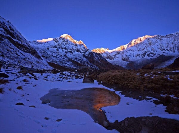
5 Day Annapurna Base Camp Trek
The 5-Day Annapurna Base Camp Trek offers a thrilling journey through Nepal’s stunning landscapes, beginning from Pokhara. Hike past...
Adventure Nepal Tour
Embark on an unforgettable Adventure Nepal Tour, where thrilling activities await in the breathtaking landscapes of the Himalayas. Experience...
5 Day Everest View Trek: Unforgettable Journey into the Himalayas
Enjoy the breathtaking beauty of the 5-Day Everest View Trek, with stunning mountain vistas blending with the richness of...
Annapurna Skyline Trek Royal Trek
Annapurna Skyline Trek is surely one of the most dazzling day treks, which encompasses cultural insights into mountain scenery....
All Nepal Tour
Nepal Tour Guide's All Nepal Tour covers the highlighted places like Bandipur, Palpa, Pokhara, Chitwan and Lumbini, and is...

