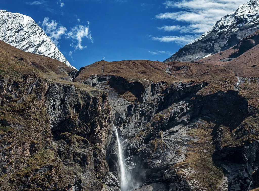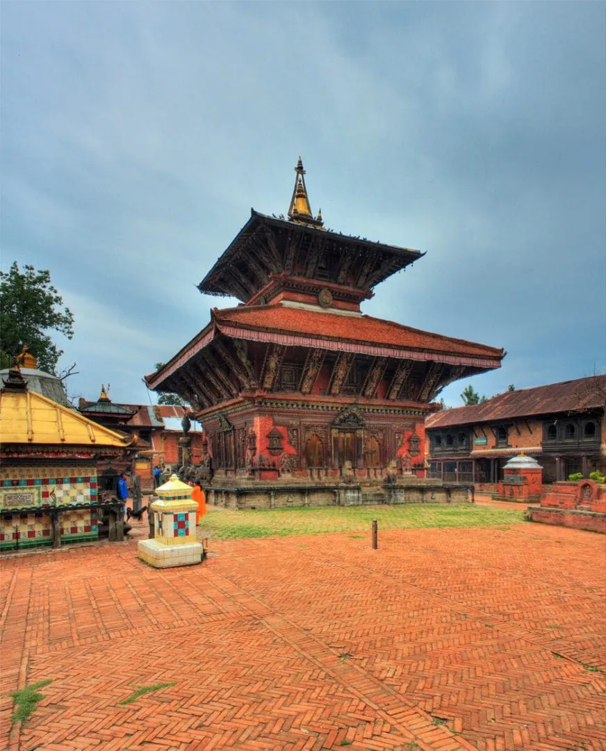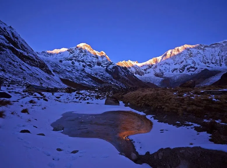
The Langtang Valley, Tamang Heritage, and Gosaikunda Lake Trek is a comprehensive 17-day Himalayan circuit in Nepal’s Rasuwa district. By combining three distinct sub-regions the cultural homestays of the Tamang Heritage Trail, the high-altitude glaciers of the Langtang Valley, and the sacred alpine lakes of Gosaikunda it delivers an all-in-one trek without the heavy commercial crowd of the Everest or Annapurna regions. The trail ranges in altitude from 1,460 meters at Syabrubesi to high-point viewpoints reaching 4,380 meters at Gosaikunda Lake and 4,984 meters at Tserko Ri.
Langtang Valley, Tamang Heritage and Gosaikunda Trek at a Glance
The Langtang Valley, Tamang Heritage Trail, and Gosaikunda Lake Trek is a complete Langtang-region circuit that combines Tamang villages, Buddhist heritage, forest trails, Kyanjin Gompa, Himalayan views, sacred alpine lakes, and Lauribina La Pass. It is best for trekkers who have more than two weeks and want a culturally immersive route rather than a short mountain view trek.
The complete journey usually begins with a road journey from Kathmandu to Syabrubesi. It follows the Tamang Heritage Trail through Gatlang, Tatopani, Thuman, Nagthali, and Briddim, then joins the main Langtang Valley route to Lama Hotel, Langtang Village, and Kyanjin Gompa. From there, the trek continues through Thulo Syabru and Sing Gompa to Gosaikunda Lake before crossing Lauribina La and descending through the Helambu side.
The route is demanding because it combines multiple trekking regions, repeated uphill and downhill walking, and high-altitude travel. It is not technical climbing, but it requires good physical preparation, a flexible itinerary, and careful altitude management.
Key trek facts
- Trek duration: 17 to 20 days, depending on route pacing, Kathmandu nights, and contingency days.
- Starting point: Syabrubesi, reached by road from Kathmandu.
- Finishing point: Sundarijal, Helambu, Dhunche, or Syabrubesi, depending on the itinerary.
- Highest overnight stop: Gosaikunda Lake at approximately 4,380 m.
- Highest trail point: Lauribina La Pass at approximately 4,610 m.
- Main cultural region: Tamang villages of Rasuwa and Helambu.
- Accommodation style: Teahouses, village lodges, and selected homestay-style stays.
- Best trekking seasons: Spring, March to May, and autumn, September to November.
Why this combined trek is worth doing
This trek is worth doing because it delivers three distinct travel experiences in a single route: Tamang cultural heritage, the high Himalayan valley of Langtang, and the sacred alpine landscape of Gosaikunda. Instead of simply walking to a viewpoint and returning on the same trail, trekkers move through changing communities, forests, valleys, ridges, lakes, and high passes.
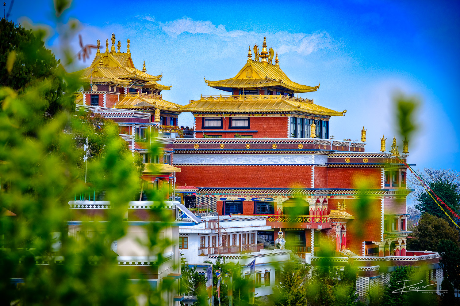
The Tamang Heritage Trail makes the journey culturally richer. Villages such as Gatlang, Tatopani, Thuman, Nagthali, and Briddim offer opportunities to see traditional stone houses, Buddhist prayer flags, monasteries, local farming, village hospitality, and regional food. Tatopani also adds a hot-spring experience, while Nagthali is valued for its ridge-top Himalayan views.
The Langtang Valley section adds the classic mountain scenery: Langtang River forests, yak pastures, Langtang Village, Kyanjin Gompa, glaciers, and viewpoints such as Kyanjin Ri or Tserko Ri. Gosaikunda then changes the atmosphere completely, replacing the broad valley with sacred lakes, exposed high-altitude terrain, and the challenge of Lauribina La Pass.
For travelers choosing between the standard Langtang Valley Trek and the longer combination route, the decision is simple: choose Langtang Valley alone if you have limited time; choose the combined itinerary if cultural depth, a sacred lake, and a high-pass crossing matter as much as mountain views.
Route, duration and realistic pacing
A well-paced Langtang Valley, Tamang Heritage, and Gosaikunda itinerary takes 17 to 20 days. This duration is not excessive; it allows time for cultural exploration, gradual altitude gain, acclimatization at Kyanjin Gompa, and a safe approach to Gosaikunda and Lauribina La.
A shorter itinerary may be possible for highly experienced trekkers, but cutting too many days can make the trip unnecessarily exhausting. The most important days to protect are the Kyanjin Gompa acclimatization day and the high-altitude Gosaikunda section. A traveller who reaches the pass tired, dehydrated, or poorly acclimatized has a less safe and less enjoyable experience.
A practical route division looks like this:
- Tamang Heritage Trail: About 3 to 4 trekking days.
- Langtang Valley to Kyanjin Gompa: About 5 to 6 days, including acclimatization.
- Thulo Syabru to Gosaikunda and Lauribina La: About 4 to 5 days.
- Helambu-side exit or return journey: About 2 to 3 days.
- Kathmandu logistics: 2 to 3 days for arrival, preparation, road travel, and departure buffer.
The Langtang–Gosaikunda route alone is frequently packaged in 14- to 16-day versions. Adding the Tamang Heritage Trail creates a longer itinerary, but it makes the journey more distinctive and more valuable for visitors seeking culture alongside trekking.
Difficulty, altitude and fitness
The trek is moderate to strenuous. Fit beginners can do it with proper preparation, a guide, and an itinerary that does not rush the ascent, but it should not be presented as an easy trek. The challenge comes from consecutive trekking days, uneven stone trails, repeated ascents and descents, changing weather, and elevations above 4,000 m.
Most days require approximately 4 to 7 hours of walking. The Gosaikunda to Ghopte day via Lauribina La is usually the most difficult day because trekkers cross the highest pass, walk on exposed high-altitude terrain, and then make a long descent. Depending on weather, snow, and group pace, this day can take 6 to 8 hours.enticinghimalayas+1
The route includes three key elevation points:
- Kyanjin Gompa: Approximately 3,870 m.
- Gosaikunda Lake: Approximately 4,380 m.
- Lauribina La Pass: Approximately 4,610 m.
Trekkers may hike higher during the Kyanjin Gompa acclimatization day if they choose Kyanjin Ri or Tserko Ri. Those viewpoint hikes should be described as optional acclimatization hikes, not compulsory itinerary stages, because the appropriate choice depends on weather, fitness, and how each traveler feels at altitude.explorehimalaya+2
Acclimatization and altitude safety
Altitude sickness is a serious consideration on this route because it climbs from Kathmandu at roughly 1,400 m to Gosaikunda at around 4,380 m, before crossing Lauribina La at about 4,610 m. Physical fitness helps with trekking stamina, but it does not prevent altitude illness.
The safest strategy is to walk slowly, drink enough fluids, eat regular meals, avoid alcohol at high elevation, and include an acclimatization day at Kyanjin Gompa. Trekkers should not climb higher if they have concerning symptoms, and they should never continue uphill when symptoms are getting worse.
Symptoms that require immediate communication with the guide include severe or persistent headache, vomiting, dizziness, loss of coordination, confusion, chest tightness, shortness of breath at rest, and unusual exhaustion. The safest response to worsening altitude symptoms is to stop ascending and descend with assistance when necessary.
A trustworthy trekking company should never guarantee that a traveller will reach the pass. Weather, snow, health, and local trail conditions can require changes to the itinerary. This transparency improves safety and demonstrates experience based travel guidance.
Lauribina La Pass and Gosaikunda Lake
Lauribina La Pass is the physical and scenic highlight of the Gosaikunda section. At about 4,610 m, it is the highest point on the standard route and requires an early start from the Gosaikunda area. The pass is not normally a technical climbing route during stable trekking seasons, but high altitude and weather exposure make it demanding.
The trail may be affected by strong wind, cold, snow, ice, fog, and rapidly changing visibility. Trekkers should carry a waterproof outer layer, warm insulation, gloves, a warm hat, sunglasses, sunscreen, water, snacks, and a headlamp in their own daypack. Footwear should be broken in before the trek; new boots often cause blisters during long descents.
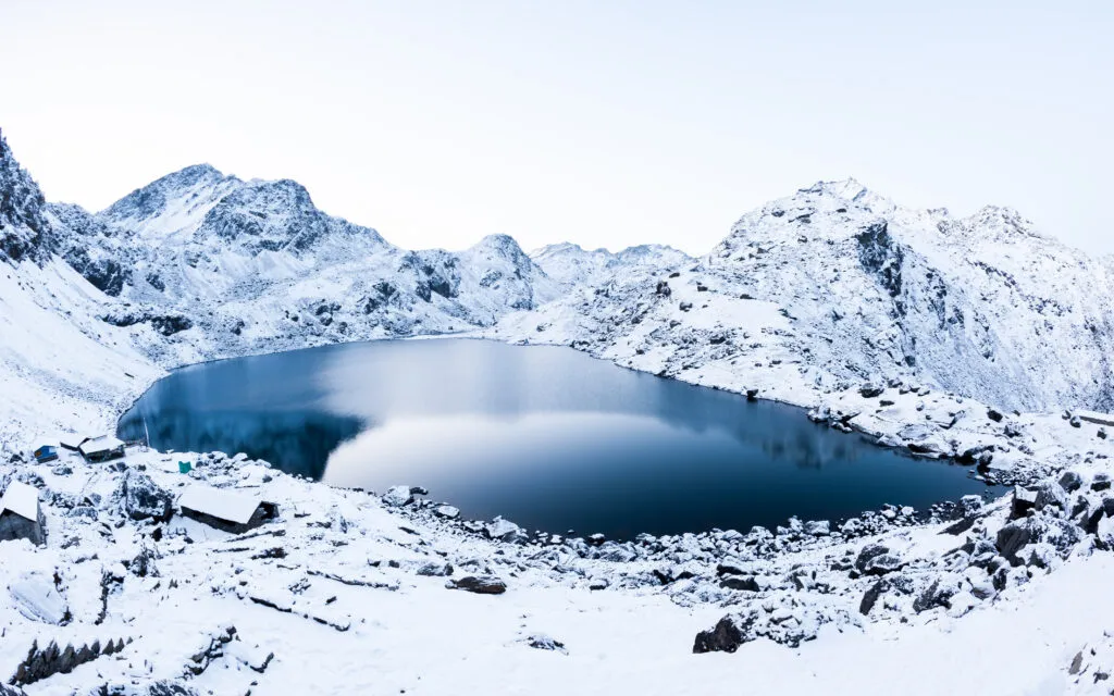
Gosaikunda Lake is more than a viewpoint. It is an important pilgrimage site for Hindu and Buddhist communities, so visitors should behave respectfully around the lake. Do not litter, swim, interfere with religious offerings, or create excessive noise in sacred areas. Gosaikunda is approximately 4,380 m, which means accommodation is basic and nighttime temperatures can be very low.
Tamang Heritage Trail experience
The Tamang Heritage Trail is the cultural foundation of this itinerary. It gives travelers time in the villages of the Langtang region before they reach the more famous alpine sections. This is especially valuable for travelers who want meaningful local experiences, not only viewpoints and trekking statistics.
Gatlang introduces the village architecture and Tamang community setting. Tatopani provides natural hot springs and a slower cultural stop. Thuman is known for Tamang culture, Buddhist traditions, and traditional settlement character. Nagthali offers a higher ridge experience with wide views, while Briddim provides a quieter village stay before the route joins the Langtang Valley trail.
The Tamang Heritage Trail is generally less challenging in altitude than Gosaikunda, but it is not flat. It includes long days of climbing and descending between villages. This makes it suitable as an early conditioning section of the longer trek, provided the itinerary does not move too fast.
Guide, permits and solo trekking
For this trek, a licensed guide is strongly recommended. A guide helps with route navigation, permits, accommodation, trail changes, food ordering, local communication, weather decisions, and altitude monitoring. This support becomes particularly valuable in the remote and high sections between Sing Gompa, Gosaikunda, Lauribina La, and Ghopte.
Do not publish an unconditional statement that solo trekking is allowed. Nepal’s trekking regulations and local enforcement can change, and different sources may report different arrangements. Your page should state that travelers must confirm the latest guide and permit rules with the Nepal Tourism Board or a Nepal-registered trekking agency before departure.
The main permit normally associated with the region is the Langtang National Park entry permit. Recent sources commonly list it at NPR 3,000 for foreign nationals and NPR 1,500 for SAARC nationals, while TIMS rules and fees should be verified before booking because requirements may change. Include a visible “permit information last verified on” date on your published page.
Best time and seasonal conditions
The best time for the Langtang Valley, Tamang Heritage, and Gosaikunda Trek is spring, from March to May, and autumn, from September to November. These seasons usually offer the best balance of trail access, daylight, weather stability, and mountain visibility.
Autumn is popular for clear skies, dry conditions, and crisp mountain views. October is often considered one of the strongest months for the route. Spring is warmer at lower elevations and brings rhododendron blooms along forest sections, although afternoon clouds can develop.
Winter trekking is possible for experienced and well-equipped trekkers, but snow and ice can complicate the Gosaikunda and Lauribina La section. Trekkers should allow an extra contingency day and avoid making fixed onward travel plans immediately after the trek. During monsoon, rain, leeches, cloud cover, slippery trails, landslide risk, and road delays are more likely.
Transport and road access
The standard road approach begins in Kathmandu and ends at Syabrubesi. The drive usually takes around 7 to 9 hours, depending on traffic, road construction, weather, landslides, and the vehicle type. Local buses are lower-cost, while private jeeps are generally faster and more comfortable, especially for groups.
The final road sections can be rough, so travel times should always be written as estimates. Avoid promising a fixed arrival time for Syabrubesi. During monsoon or after major weather events, road conditions can change rapidly.
The trek can finish in different places depending on the chosen route. A full circuit often exits toward Helambu and Sundarijal before returning to Kathmandu. Some itineraries retrace the route through Dhunche or Syabrubesi instead. This flexibility should be clearly stated in the itinerary, because it affects total duration, transport arrangements, and pricing.
Accommodation, meals and connectivity
The route uses basic teahouses, village lodges, and some community or homestay-style accommodation. Trekkers should not expect luxury facilities in high-altitude locations. Rooms are usually simple, and bathrooms may be shared. During peak seasons, rooms can fill quickly, particularly around Kyanjin Gompa, Sing Gompa, and Gosaikunda.
Food is generally cooked fresh in the lodges. Common meals include dal bhat, noodles, soup, fried rice, potatoes, eggs, Tibetan bread, tea, and seasonal local dishes. Dal bhat is often a practical meal for trekking because it provides carbohydrates, lentils, vegetables, and usually extra servings.
Charging, Wi-Fi, hot showers, and mobile networks are available in some villages but should never be guaranteed. Services may cost extra, depend on solar power or local electricity, and become less reliable at high altitude. Advise travelers to carry cash, a power bank, offline maps, downloaded travel documents, and a backup communication plan.
Cost planning and cash
The full trek costs more than a standard Langtang Valley Trek because it has more trekking days, more meals and lodge nights, a longer guide and porter requirement, and a high-pass crossing. Cost varies by season, group size, transportation choice, accommodation standard, guide and porter arrangements, and whether permits are included.
Instead of giving one fixed price, divide the cost section into three traveler categories:
- International travelers: Quote in USD and show what is included and excluded.
- SAARC travelers: Show permit differences and a separate price range where applicable.
- Nepali travelers: Show domestic transport, permit, and food-cost estimates in NPR.
Trekkers should carry enough Nepalese rupees for snacks, hot drinks, charging, Wi-Fi, showers, tips, souvenirs, personal gear replacement, and emergencies. ATMs are not reliable after leaving Kathmandu, and mobile payment systems may not work consistently in remote villages. Crowd-sourced Reddit budgets can help identify cost concerns, but they should not be used as fixed pricing because meal costs and road fares change over time.
Packing and preparation
Pack for warm low-altitude walking, rain, wind, and cold conditions above 4,000 m. The most important principle is layering: trekkers should be able to add or remove clothing as conditions change throughout the day.
Essential trekking gear includes broken-in trekking boots, moisture-wicking base layers, a fleece, insulated jacket, waterproof jacket and trousers, gloves, warm hat, sunglasses, sunscreen, lip balm, trekking poles, headlamp, reusable water bottles, water-purification tablets or filter, power bank, and personal first-aid items.
Keep vital items in the personal daypack: passport copy, insurance details, cash, medications, water, snacks, waterproof layer, gloves, phone, and headlamp. If using a porter, do not place essential medicines or warm layers only in the porter bag.
For winter trips, add heavier insulation and seek guide advice about traction devices if snow or ice is expected around Gosaikunda and Lauribina La
Why Combine Langtang Valley, Tamang Heritage and Gosaikunda?
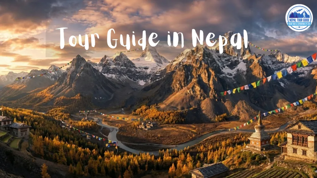
Combining these routes gives travelers a fuller story of the Langtang region. The Tamang Heritage Trail introduces the communities, traditions, and everyday life of the lower hills. Langtang Valley provides the classic Himalayan landscape of forests, yak pastures, glaciers, and high peaks. Gosaikunda adds a sacred high-altitude lake and the challenge of crossing a mountain pass.
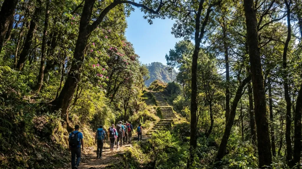
The route works especially well because the landscape changes naturally day by day. You begin with stone houses, terraced fields, monasteries, and village trails. Later, you walk through rhododendron and pine forest, follow the Langtang River, pass yak grazing areas, and finally enter a stark alpine environment around Gosaikunda.
The Tamang Heritage Trail is what makes this itinerary different from a normal Langtang Valley Trek. Villages such as Gatlang, Tatopani, Thuman, Nagthali, and Briddim offer a more personal cultural experience. Tatopani’s natural hot springs, Nagthali’s ridge views, Buddhist prayer sites, local food, and Tamang hospitality add value before the high-altitude portion begins.
Choose this complete route if you want:
- A longer, more diverse Himalayan trekking holiday
- Both cultural villages and high mountain scenery
- A sacred-lake experience at Gosaikunda
- A challenging but non-technical high pass
- A route with more variety than an out-and-back Langtang Valley Trek
Choose Langtang Valley only if you have fewer days, prefer lower overall difficulty, or do not want to cross Lauribina La.
Route Map, Starting Point and Finishing Point
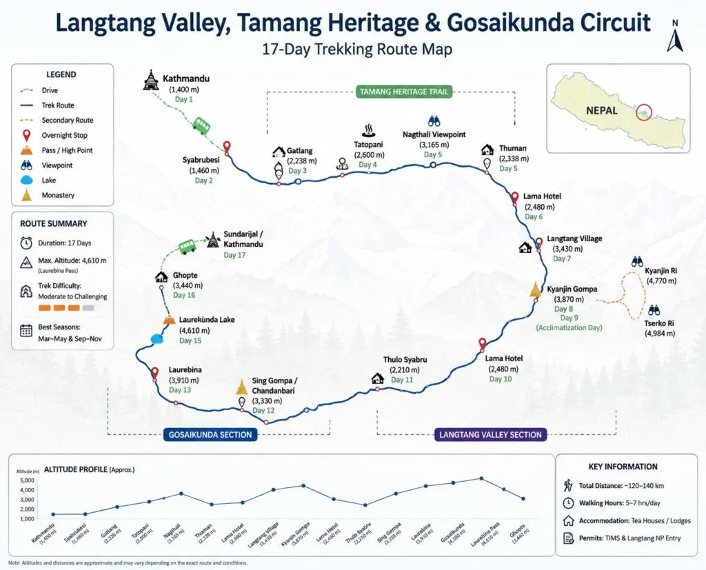
The trek normally begins with a drive from Kathmandu to Syabrubesi. From there, the route follows the Tamang Heritage Trail before joining the main Langtang Valley trail. After Kyanjin Gompa, trekkers descend and turn toward Thulo Syabru, Sing Gompa, Gosaikunda Lake, and Lauribina La Pass.
A practical full-route sequence is:
Kathmandu → Syabrubesi → Gatlang → Tatopani → Thuman → Nagthali → Briddim → Lama Hotel → Langtang Village → Kyanjin Gompa → Lama Hotel → Thulo Syabru → Sing Gompa → Laurebina Yak → Gosaikunda → Lauribina La → Ghopte → Tharepati → Gul Bhanjyang → Chisopani → Sundarijal → Kathmandu
Syabrubesi is the usual starting point for the Langtang Valley and Tamang Heritage Trail. It sits at roughly 1,500 m and is reached by road from Kathmandu. The complete circuit generally finishes at Sundarijal after descending from the Helambu side, followed by a short drive back to Kathmandu.
Some shorter route variations return through Dhunche or Syabrubesi instead. This choice affects the total duration, transport cost, and whether trekkers cross Lauribina La.
How Many Days Do You Need ?
For the full Langtang Valley, Tamang Heritage and Gosaikunda Trek, allow 17 to 20 days. This is the most realistic duration for travelers who want proper acclimatization, village exploration, reasonable daily walking hours, and a flexible buffer around the Gosaikunda section.
A shorter plan is possible, but it means removing important elements. Many 12- to 16-day itineraries cover Langtang Valley and Gosaikunda without the full Tamang Heritage Trail. A 10-day trek is normally too short for this complete circuit unless you are willing to use very long walking days and skip cultural stops.
A comfortable time breakdown looks like this:
- Kathmandu arrival and preparation: 1 to 2 days
- Kathmandu to Syabrubesi transport: 1 day
- Tamang Heritage Trail: 3 to 4 days
- Langtang Valley and Kyanjin Gompa: 5 to 6 days
- Acclimatization at Kyanjin Gompa: 1 day
- Gosaikunda and Lauribina La section: 4 to 5 days
- Helambu-side descent and Kathmandu return: 2 to 3 days
The main point is simple: do not remove the acclimatization day at Kyanjin Gompa just to make the package shorter. It provides a safer transition before you continue toward Gosaikunda and Lauribina La.
Trek Difficulty, Fitness and Daily Walking Hours
The complete route is moderate to strenuous. It does not require ropes, climbing experience, or technical mountaineering skills in normal trekking-season conditions, but it does require stamina, patience, and sensible pacing.
The Tamang Heritage Trail has repeated climbs and descents between villages. The Langtang Valley section becomes harder as altitude increases. The most physically demanding day is usually the crossing from Gosaikunda over Lauribina La Pass to Ghopte, where altitude, wind, cold, rocky terrain, and a long descent come together.
Most days involve around 4 to 7 hours of walking. The Lauribina La crossing day can take 6 to 8 hours or longer if there is snow, strong wind, fog, or a slower group pace.
This trek is suitable for fit beginners if they prepare well. Before arriving in Nepal, aim to build a routine that includes:
- Long walks on hills or stairs
- Cardio exercise three to five times per week
- Short hikes carrying a light daypack
- Leg-strength training for knees, glutes, and calves
- Practice walking in the trekking boots you plan to use
You do not need to be an athlete. However, you should be comfortable walking several days in a row on uneven trails while carrying water, warm clothing, rain gear, snacks, and personal essentials.
Gosaikunda Lake and Lauribina La Pass
Gosaikunda Lake is the spiritual and physical centerpiece of the upper part of the trek. It is a sacred alpine lake in Langtang National Park, located at approximately 4,380 m. For many travelers, arriving at the lake after days of forest, village, and mountain walking is the emotional highlight of the journey.
The lake is important to Hindu pilgrims and is also respected by Buddhist communities in the region. During Janai Purnima, the area becomes very busy with pilgrims. The atmosphere can be meaningful and vibrant, but accommodation can be crowded and services may be stretched.
Lauribina La Pass is the highest standard point on the route, commonly listed at around 4,610 m. It is usually crossed early in the morning after staying near Gosaikunda. The pass is not technical climbing, but it can be demanding because of altitude, exposure, cold, wind, snow, ice, and poor visibility.
Carry these items in your personal daypack on the pass day:
- Waterproof jacket and rain trousers
- Insulated jacket or warm mid-layer
- Gloves and warm hat
- Sunglasses and sunscreen
- Water and energy snacks
- Headlamp
- Personal medicine
- Phone, power bank, and emergency contact details
Never promise clients that the pass crossing is guaranteed. Winter snow, heavy rain, strong wind, health issues, or trail conditions can require a guide to change the plan.
Tamang Heritage Trail Villages and Culture
The Tamang Heritage Trail gives the trek its cultural identity. It takes travelers beyond the better-known Langtang Valley route and into communities where Tamang culture, Buddhist traditions, farming life, and mountain hospitality remain central to everyday life.
Gatlang is often the first major village on the trail. It is known for its traditional settlement layout, stone houses, terraced fields, and Tamang community atmosphere.
Tatopani is known for natural hot springs. After a day of walking, the warm-water experience can be a memorable and relaxing stop, depending on local access and conditions.
Thuman is a traditional village where travelers can observe local architecture, prayer flags, monasteries, and community life. It is one of the places where guides can add real value by explaining culture respectfully rather than treating villages as sightseeing stops.
Nagthali is a higher ridge area that offers broad Himalayan views in clear weather. It was historically used as a grazing area and is now valued as a scenic stop between the cultural villages.
Briddim offers a quieter village experience and is often used as a community-lodge or homestay-style stop before joining the Langtang Valley route.
Respect matters in every village. Ask before photographing people, dress modestly around monasteries, avoid wasting water, and buy local food or services where possible. Responsible trekking supports the communities that make the route possible.
Best Time, Weather, Winter and Monsoon
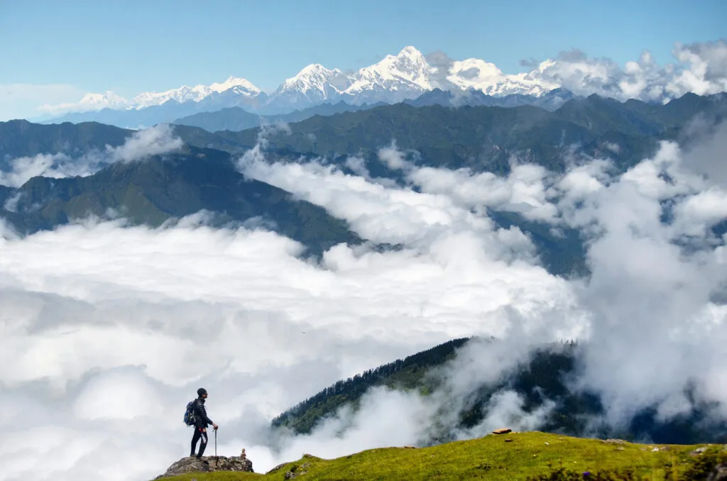
The best seasons for the complete trek are spring, from March to May, and autumn, from September to November. These periods usually provide the most reliable conditions for the high Gosaikunda and Lauribina La section.outdoorhimalayan+1
Spring: March to May
Spring brings warmer daytime temperatures, flowering rhododendrons in forest sections, and generally good trekking conditions. Afternoon clouds can build, especially later in the season, so morning views are often clearer.
Spring is a strong choice for travelers who enjoy greenery, flowers, and slightly warmer lower-elevation trekking.
Autumn: September to November
Autumn is often considered the most reliable period for clear skies, dry trails, sharp mountain views, and stable conditions after the monsoon. October is especially popular, so popular teahouses may fill earlier in the day.
This is the best option for travelers whose top priority is mountain visibility and a more reliable chance of crossing Lauribina La in stable conditions.
Winter: December to February
Winter trekking is possible, but it requires flexibility and stronger preparation. Gosaikunda may freeze, while snow and ice can affect Lauribina La. Nights can be extremely cold, and lodge services may be more limited.
Winter is better for experienced trekkers with good equipment, a reliable guide, extra contingency days, and no fixed onward flight immediately after the trek.
Monsoon: June to August
Monsoon brings green landscapes, fewer trekkers, and a quieter trail, but it also brings rain, clouds, leeches, slippery paths, landslide risk, and road delays. The full Gosaikunda and Lauribina La route is less predictable during this period.
If trekking in monsoon, keep the itinerary flexible and choose a guide or operator that provides honest, updated trail and road information.
Permits, TIMS, Guide Rules and Solo Trekking
The trek enters Langtang National Park, so a park-entry permit is required. According to Nepal Tourism Board information, the current Langtang National Park entry fee is NPR 3,000 for foreign nationals, NPR 1,500 for SAARC nationals, and NPR 100 for Nepali visitors. Children below 10 years are listed as free.
Nepal Tourism Board also includes Langtang Trek, Langtang Gosaikund Trek, Tamang Heritage Trek, and Tamang Heritage Langtang Trek in its TIMS information. Because TIMS processes, guide policies, and practical enforcement can change, verify the latest requirements through the Nepal Tourism Board or a registered Nepal trekking agency shortly before travel.
Sources : ntb.gov
For a full combination trek, a licensed guide is strongly recommended. A guide can help with:
- Route navigation and trail decisions
- Lodge bookings during busy seasons
- Monitoring altitude symptoms
- Weather decisions before Lauribina La
- Communication in villages and teahouses
- Permit handling and local procedures
- Explaining Tamang culture and Gosaikunda etiquette
- Managing itinerary changes during road delays or snowfall
Do not market solo trekking as automatically permitted. Travelers may find old blogs and Reddit reports describing independent trips, but regulations and local requirements need to be checked before the trek begins.
Kathmandu to Syabrubesi Transport and Road Conditions
The normal gateway journey is Kathmandu to Syabrubesi by road. Travelers can use a public bus, shared jeep, tourist vehicle, or private jeep.
Public buses are cheaper but usually slower and less comfortable. Shared jeeps are often quicker but can be crowded. Private jeeps are more convenient for families, groups, and travelers carrying extra luggage, though they cost more.
The drive generally takes around 7 to 9 hours, but this should always be presented as an estimate. Traffic, roadworks, rain, landslides, and vehicle type can change the journey time significantly.
The road is a normal and widely used approach route, but some parts can be rough. During monsoon, allow extra time and avoid booking a tight international-flight connection on the day after your return from the trek.
For Gosaikunda-only itineraries, many domestic trekkers begin from Dhunche instead. Dhunche is a practical starting point for travelers who have fewer days and want to focus on Gosaikunda without completing the full Langtang circuit.
Accommodation, Food, Wi-Fi, Charging and Hot Showers
The trek follows a teahouse model. Most overnight stops have basic lodges or village guesthouses, but standards vary widely by elevation, season, and location.
Expect simple twin rooms, shared bathrooms in many places, dining halls heated by a stove where available, and basic bedding. Carrying a sleeping bag or sleeping-bag liner is still a good idea because nights can be cold and extra blankets may not always be available.
Common overnight stops with teahouses include:
- Syabrubesi
- Gatlang
- Tatopani
- Thuman
- Briddim
- Lama Hotel
- Langtang Village
- Kyanjin Gompa
- Thulo Syabru
- Sing Gompa
- Laurebina Yak
- Gosaikunda
- Ghopte
- Tharepati
Food is simple, fresh, and practical for trekking. Typical menu items include dal bhat, vegetable curry, noodles, fried rice, soup, potatoes, eggs, Tibetan bread, momo, tea, coffee, and seasonal local dishes.
Dal bhat is often one of the best trekking meals because it provides rice, lentils, vegetables, and energy for long walking days. At high altitude, eat enough even if your appetite is lower than usual.
Wi-Fi, charging, hot showers, and mobile signal may be available at many stops, but they should never be guaranteed. Services can cost extra, depend on solar power or local electricity, and become less reliable near Gosaikunda and remote sections of the route.
Carry a power bank, offline maps, downloaded documents, cash, and a backup communication plan.
Detailed Cost Breakdown and Cash Requirements
The cost of this trek depends on your nationality, group size, season, transport choice, guide and porter arrangements, accommodation level, and package inclusions. A full 17- to 20-day itinerary will cost more than a short Langtang Valley or Gosaikunda trek because it includes more lodge nights, more meals, longer staff support, and a bigger route.
A transparent package-cost page should separate the following:
- International traveler package price
- SAARC traveler package price
- Nepali traveler domestic package price
- Private trek cost
- Group-joining trek cost
- Guide-only cost
- Guide and porter cost
- Budget for personal expenses
Your page should clearly state whether the price includes:
- Airport transfers
- Kathmandu hotel nights
- Transport to Syabrubesi
- Transport from Sundarijal or the trek endpoint
- Langtang National Park permit
- TIMS documentation, if currently required
- Licensed guide
- Porter service
- Accommodation during the trek
- Meals during the trek
- Insurance for guides and porters
- Government taxes
- Emergency support arrangements
Personal expenses normally include snacks, bottled drinks, alcoholic drinks, charging, Wi-Fi, hot showers, tips, souvenirs, personal gear, travel insurance, and extra hotel nights caused by delays.
Carry Nepalese rupees before leaving Kathmandu. Do not rely on ATMs or card payments in the trekking region. Bring extra cash for unexpected delays, extra meals, a change in transport plan, or additional lodge nights.
Packing List and Travel Insurance
The route moves from relatively warm lower hills to high, windy, and potentially freezing terrain around Gosaikunda and Lauribina La. Pack with a layering system rather than carrying one very heavy outfit.
Clothing
- Moisture-wicking trekking shirts
- Thermal base layers
- Fleece jacket or warm mid-layer
- Insulated down or synthetic jacket
- Waterproof jacket and rain trousers
- Trekking trousers
- Warm hat and sun hat
- Gloves or insulated mittens
- Trekking socks and spare socks
- Comfortable clothing for evenings
Footwear and trekking gear
- Broken-in waterproof trekking boots
- Camp shoes or sandals
- Trekking poles
- Daypack with rain cover
- Duffel bag for porter-carried luggage
- Sleeping bag or sleeping-bag liner
- Headlamp and spare batteries
- Reusable water bottles or hydration bladder
Health and personal items
- Water-purification tablets, filter, or UV purifier
- Sunscreen and lip balm
- Sunglasses with UV protection
- Personal medicine
- Blister plasters and basic first-aid supplies
- Hand sanitizer and toilet paper
- Quick-dry towel
- Power bank
- Passport copies and insurance details
International trekkers should have travel insurance that covers trekking at the actual maximum altitude planned. Lauribina La is approximately 4,610 m, and optional Tserko Ri hikes may reach close to 4,984 m. Check the policy’s altitude limit, emergency helicopter-evacuation terms, medical cover, and exclusions before purchase.
Responsible Trekking and Gosaikunda Etiquette
Responsible trekking protects the landscape, supports local communities, and respects the spiritual significance of Gosaikunda.
Gosaikunda is not simply a scenic lake. It is an important sacred destination for Hindu pilgrims and is also respected by Buddhist communities in the region. Treat the lakeshore, temples, prayer sites, and pilgrims with care.
Follow these principles:
- Carry reusable water bottles and minimize single-use plastic
- Do not leave waste on the trail or at the lake
- Do not swim in or pollute sacred water
- Ask before photographing local people, monks, or religious activities
- Dress respectfully in monasteries and villages
- Keep noise low around prayer sites and Gosaikunda Lake
- Support local lodges, guides, and village businesses
- Do not pressure guides, porters, or staff to continue in unsafe weather
- Follow Langtang National Park rules and local authority instructions
Nepal’s Department of National Parks and Wildlife Conservation states that valid entry permits are required to enter Langtang National Park.
Our TripAdvisor review :Tour Guide in Nepal
Content Reviewed By
Nepal Tour Guide Team Trek & Expedition Pvt. Ltd.
A licensed trekking and tour operator in Nepal, specializing in unforgettable Himalayan adventures across the Everest, Annapurna, Langtang, and Manaslu regions. Led by experienced local guides, we create safe, personalized, and responsible trekking experiences with expert knowledge of Nepal’s mountains, culture, and trail conditions.
Legal document:Tour Guide in Nepal